10b Data Analytics: Spatial Continuity
Lecture on the impact of spatial continuity to motivate characterization and modeling of spatial continuity.
From playlist Data Analytics and Geostatistics
22 Spatial Data Analytics: Decision Making
Spatial data analytics course lecture on optimum decision making in the presence of uncertainty.
From playlist Spatial Data Analytics and Modeling

01b Spatial Data Analytics: Subsurface Data
Lecture of the data available for subsurface modeling.
From playlist Spatial Data Analytics and Modeling

The Defence Context, Geospatial Standards for Data Science - Dr Paul Cripps, Dstl
About the event Advances in geospatial technologies have led to a significant increase in the role of geospatial data across sectors such as agriculture, aviation, energy, utilities, hydrology, smart cities, government, health and others. As more geospatial data has been collected and ana
From playlist Geospatial Standards for Data Science

02d Spatial Data Analytics: Example Project Update
Example project update oral presentation. I recorded this to provide my students with an example update presentation on spatial data analytics with the provided spatial data set.
From playlist Spatial Data Analytics and Modeling

21b Spatial Data Analytics: Dispersion Variance
Subsurface modeling course lecture on dispersion variance.
From playlist Spatial Data Analytics and Modeling

Geospatial Standards for Data Science - Dr Gobe Hobona, OGC
About the event Advances in geospatial technologies have led to a significant increase in the role of geospatial data across sectors such as agriculture, aviation, energy, utilities, hydrology, smart cities, government, health and others. As more geospatial data has been collected and ana
From playlist Geospatial Standards for Data Science
21 Spatial Data Analytics: Spatial Scale
Subsurface modeling course lecture on scale.
From playlist Spatial Data Analytics and Modeling

Spatial data aggregration session 1 examples
Examples of landslide susceptibility, mineral and geothermal potential mapping
From playlist Spatial data aggregation

Walter Jetz showcases the Map of Life project, a collaborative academic effort to help mobilize and bring together different species distribution data types and sources, providing model-based integration and a system for the community to build upon this knowledge.
From playlist Spatial Biodiversity Science and Conservation

Local & Regional Policy & Management: Cities and Spatial Planning
Including ESS in Natural Resource management (Agriculture and forestry), protected areas
From playlist TEEB @ Yale

Fellow Short Talks: Sir Alan Wilson (UCL, CEO The Alan Turing Institute)
Sir Alan Wilson was responsible for a number of techniques in urban modelling, which are now commonly applied, such as the use of entropy in building spatial interaction models. He rigorously deployed accounts concepts in demography and economic modelling. His current research, supported b
From playlist Short Talks

25c3: Mining social contacts with active RFID
Speakers: Ciro Cattuto, Milosch Meriac, aestetix We describe the implementation of a distributed proximity detection firmware for the OpenBeacon RFID platform. We report on experiments performed during conference gatherings, where the new feature of proximity detection was used to mine an
From playlist 25C3: Nothing to hide

Sneak Peek at Version 13 of Wolfram Language
Join Jon McLoone as he demonstrates the new features and functionalities in Version 13 of Wolfram Language.
From playlist Sneak Peek at Version 13 of Wolfram Language (Clips and Full Stream)

Methane 'Super-Emitters' Detected by NASA's New Earth Science Mission (Media Telecon)
A NASA instrument installed on the International Space Station this summer has demonstrated an unanticipated capability to help better understand the impacts of climate change. EMIT, the Earth Surface Mineral Dust Source Investigation, was built by scientists to understand how dust affect
From playlist Earth

Kelling: Informing Bird Conservation at Multiple Spatial Scales
Steve Kelling discusses eBird, a global citizen science effort to centralize bird observations. Kelling shows recent work that has used occurrence data to generate spatial and temporal models of birds.
From playlist Spatial Biodiversity Science and Conservation

SWOT: Earth Science Satellite Will Help Communities Plan for a Better Future
A new Earth science mission, led by NASA and the French space agency Centre National d’Études Spatiales (CNES), will help communities plan for a better future by surveying the planet’s salt and freshwater bodies. The Surface Water and Ocean Topography (SWOT) mission will measure the height
From playlist Earth
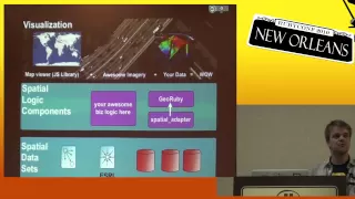
RubyConf 2010 - Spatial Programming for the Rubyist by: Peter Jackson
Spatial programming is the field that treats distance, space, and size as first-order programming concepts. Using spatial programming techniques, you can answer questions that are much more difficult -- or impossible -- to answer using standard object-relational (SQL) or document-oriented
From playlist RubyConf 2010

01d Spatial Data Analytics: Modeling Strategies
A lecture on spatial, subsurface modeling strategies and workflows.
From playlist Spatial Data Analytics and Modeling

(TUA2) Strategic digital twins for sustainable urban planning
Taken from 'Towards urban analytics 2.0' Lightning talk: Strategic digital twins for sustainable urban planning Speaker: Alistair Ford, Newcastle University As part of a Turing funded project, we have been developing models of urbanisation to simulate potential urban growth in the UK. We
From playlist Towards urban analytics 2.0