10b Data Analytics: Spatial Continuity
Lecture on the impact of spatial continuity to motivate characterization and modeling of spatial continuity.
From playlist Data Analytics and Geostatistics


10c Data Analytics: Variogram Introduction
Lecture on the variogram as a measure to quantify spatial continuity.
From playlist Data Analytics and Geostatistics
22 Spatial Data Analytics: Decision Making
Spatial data analytics course lecture on optimum decision making in the presence of uncertainty.
From playlist Spatial Data Analytics and Modeling

01b Spatial Data Analytics: Subsurface Data
Lecture of the data available for subsurface modeling.
From playlist Spatial Data Analytics and Modeling

21b Spatial Data Analytics: Dispersion Variance
Subsurface modeling course lecture on dispersion variance.
From playlist Spatial Data Analytics and Modeling

Relational Databases (part 1 of 6)
The essential concepts of relational databases. Part of a larger series teaching programming. Visit codeschool.org
From playlist Relational Databases

Rails Conf 2012 Getting Down To Earth: Geospatial Analysis With Rails by Daniel Azuma
It is no secret that location has become ubiquitous. Mobile GPS, available data sets, and easy-to-use mapping services have brought geospatial information within reach of web developers. Location already plays a significant role in many of the major services such as Twitter, Facebook, and
From playlist Rails Conf 2012
RubyConf 2010 - Spatial Programming for the Rubyist by: Peter Jackson
Spatial programming is the field that treats distance, space, and size as first-order programming concepts. Using spatial programming techniques, you can answer questions that are much more difficult -- or impossible -- to answer using standard object-relational (SQL) or document-oriented
From playlist RubyConf 2010

Using PostgreSQL to manage ArcGIS spatial data
The objective of this presentation is to show the effective use of PostgreSQL to manage Geographic Information System data (hereby referred to as GIS). The bulk of the data for Mecklenburg County, NC is edited and created with the use of ESRI‘s ArcGIS software. However, in the recent year
From playlist 2016
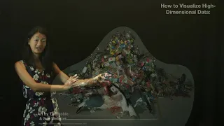
Data Visualization: Types of Data
Here I introduce different types of data and highlight common ways to visualize them. Bing Brunton's website: www.bingbrunton.com
From playlist Intro to Data Science

Using Leaflet, Node JS, and MongoDB for Web Mapping - O'Reilly Webcast
You have seen the stuff that FourSquare has done with spatial and you want some of that hotness for your app. But, where to start? Have no fear - in this webcast session you'll understand the pieces necessary to write your own location based app. The OpenShift platform already has MongoDB
From playlist O'Reilly Webcasts 3

This talk will specifically cover the challenges we encountered programming in the PL/Python environment, collaborations with some of the PySAL developers, and the power of having spatial statistics and machine learning capabilities baked right into a cloud database. These libraries, paire
From playlist 2016

DjangoCon US 2015 - Adding Geo into your Django by Corryn Smith
Adding Geo into your Django by Corryn Smith This presentation will teach the audience the basics of GIS and GeoDjango. Once you know how to set up a Django project, putting a map on your webpage hasn't been easier. During my talk, I will show you how to navigate through the GeoDjango docu
From playlist DjangoCon 2015

02d Spatial Data Analytics: Example Project Update
Example project update oral presentation. I recorded this to provide my students with an example update presentation on spatial data analytics with the provided spatial data set.
From playlist Spatial Data Analytics and Modeling

DjangoCon 2014- Geo+Django: Geo beyond the Django
B, Joe Jasinski Have you gone through the comprehensive GeoDjango docs, but wondered where to go next? Are you curious about how you can combine the power GeoDjango with other community-built tools? Do you want to create pretty maps in Python? If so, you are in the right place. Learn about
From playlist DjangoCon 2014

Where 2.0 2010: Drew Dara-Abrams, "Your Head Isn't a Spatial Database,..."
Drew Dara-Abrams (University of California, Santa Barbara), "Your Head Isn't a Spatial Database, But You Still Know the Way to San Jose"
From playlist Where 2.0 2010

Top 10 Problems Solved by PostGIS Leo Hsu
We'll cover 10 problems where we've found PostGIS to be the easiest and fastest tool for the job. Areas covered will be: Proximity Analysis Statistical aggregation of data by location Mapping Routing Geocoding Unlikely uses for PostGIS -- non-spatial problems solved by re-imagining the
From playlist 2016
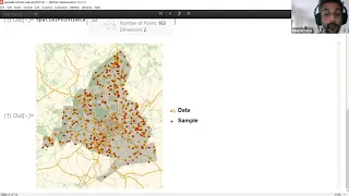
Spatial point data, also known as spatial point patterns, refers to collections of points (or events) in space. Examples include trees in a forest, gold deposits, positions of stars, earthquakes, crime locations, animal sightings, etc. The aim of spatial point data modeling is to capture t
From playlist Wolfram Technology Conference 2020

Live CEOing Ep 400: Spatial Statistics Design Review for Wolfram Language
In this episode of Live CEOing, Stephen Wolfram reviews the design of upcoming spatial statistics functionality for the Wolfram Language. If you'd like to contribute to the discussion in future episodes, you can participate through this YouTube channel or through the official Twitch channe
From playlist Behind the Scenes in Real-Life Software Design