Statistical charts and diagrams

Choropleth map

A choropleth map (from Greek χῶρος (choros) 'area/region', and πλῆθος (plethos) 'multitude') is a type of statistical thematic map that uses pseudocolor, i.e., color corresponding with an aggregate summary of a geographic characteristic within spatial enumeration units, such as population density or per-capita income. Choropleth maps provide an easy way to visualize how a variable varies across a geographic area or show the level of variability within a region. A heat map or isarithmic map is similar but uses regions drawn according to the pattern of the variable, rather than the a priori geographic areas of choropleth maps. The choropleth is likely the most common type of thematic map because published statistical data (from government or other sources) is generally aggregated into well-known geographic units, such as countries, states, provinces, and counties, and thus they are relatively easy to create using GIS, spreadsheets, or other software tools. (Wikipedia).

Choropleth map
Video thumbnail

Introduction to Dash Plotly - Data Visualization in Python

An introduction to the Dash web application framework. Dash is used to create browser-based interactive data visualization interfaces with Python. My goal is for you to understand how to use Dash. 👉 A newer version of this video can be found here - https://youtu.be/7m0Bq1EGPPg The Code: h

From playlist Introduction to Dash Plotly

Video thumbnail

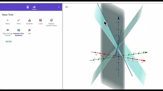
Intersection of Planes on Geogebra

In this video, we look at a strategy for finding the intersection of planes on Geogebra.

From playlist Geogebra

Video thumbnail

Drawing Sets complete in venn diagram

drawing venn diagram with geogebra, teh video going to guide how draw venn diagram from geogebra. dont forget subscribe to others our videos

From playlist Geogebra Videos

Video thumbnail

Determine if a set of points is a parallelogram using the distance formula

👉 Learn how to determine the figure given four points. A quadrilateral is a polygon with four sides. Some of the types of quadrilaterals are: parallelogram, square, rectangle, rhombus, kite, trapezoid, etc. Each of the types of quadrilateral has its properties. Given four points that repr

From playlist Quadrilaterals on a Coordinate Plane

Video thumbnail

Using a set of points determine if the figure is a parallelogram using the midpoint formula

👉 Learn how to determine the figure given four points. A quadrilateral is a polygon with four sides. Some of the types of quadrilaterals are: parallelogram, square, rectangle, rhombus, kite, trapezoid, etc. Each of the types of quadrilateral has its properties. Given four points that repr

From playlist Quadrilaterals on a Coordinate Plane

Video thumbnail

Learn Excel 2013 - "Choropleth Heat Mapping in GeoFlow": Podcast #1703

He may not be able to spell Choropleth... but he can tell us about it! After Bill's latest week-long series centering on Microsoft GoeFlow, using Real Estate and Property locations [to find a Home in Florida, USA], a question came in about Heat Mapping. Today, in Episode #1703, MrExcel add

From playlist Excel 2013

Video thumbnail

What is a Map? Crash Course Geography #2

From navigating a cross-country road trip (or just finding the nearest coffee shop), to analyzing election results, maps play a huge role in how we interpret the world! Today, we're going to talk about the differences between reference maps and thematic maps, take a closer look at how proj

From playlist Geography

Video thumbnail

Determine if a set of points is a trapezoid or not

👉 Learn how to determine the figure given four points. A quadrilateral is a polygon with four sides. Some of the types of quadrilaterals are: parallelogram, square, rectangle, rhombus, kite, trapezoid, etc. Each of the types of quadrilateral has its properties. Given four points that repr

From playlist Quadrilaterals on a Coordinate Plane

Video thumbnail

Determine if a set of points is a parallelogram by using the slope formula

👉 Learn how to determine the figure given four points. A quadrilateral is a polygon with four sides. Some of the types of quadrilaterals are: parallelogram, square, rectangle, rhombus, kite, trapezoid, etc. Each of the types of quadrilateral has its properties. Given four points that repr

From playlist Quadrilaterals on a Coordinate Plane

Video thumbnail

Determining if a set of points makes a parallelogram or not

👉 Learn how to determine the figure given four points. A quadrilateral is a polygon with four sides. Some of the types of quadrilaterals are: parallelogram, square, rectangle, rhombus, kite, trapezoid, etc. Each of the types of quadrilateral has its properties. Given four points that repr

From playlist Quadrilaterals on a Coordinate Plane

Video thumbnail

Using Folium with GeoPandas

Being able to quickly visualize your data as you work, as well as publish your results for others to see, interact with, and understand is important for any data scientist. In this video we cover creating dynamic maps with Folium. Github content: There are three notebooks, as well as th

From playlist Introduction to GeoPandas

Video thumbnail

Python Maps with Folium

In this Python tutorial we will go over how to create maps with the folium package. folium jupyter notebook with examples: https://github.com/groundhogday321/python-folium folium jupyter notebook toggle marker groups: https://github.com/groundhogday321/python-folium-toggle-marker-groups

From playlist Data Visualization for Data Science

Video thumbnail

Determine if a set of points makes up a rectangle using the distance formula

👉 Learn how to determine the figure given four points. A quadrilateral is a polygon with four sides. Some of the types of quadrilaterals are: parallelogram, square, rectangle, rhombus, kite, trapezoid, etc. Each of the types of quadrilateral has its properties. Given four points that repr

From playlist Quadrilaterals on a Coordinate Plane

Video thumbnail

Data Visualization with D3.js - Full Tutorial Course

⭐️ Watch the updated version of this course: https://youtu.be/2LhoCfjm8R4 In this data visualization course, you’ll learn how to transform data into meaningful graphical forms using D3.js and web technologies. D3 is a JavaScript library for visualizing data with HTML, SVG, and CSS. Beside

From playlist Data Science

Video thumbnail

Using the slope formula to determine if points make up a rectangle

👉 Learn how to determine the figure given four points. A quadrilateral is a polygon with four sides. Some of the types of quadrilaterals are: parallelogram, square, rectangle, rhombus, kite, trapezoid, etc. Each of the types of quadrilateral has its properties. Given four points that repr

From playlist Quadrilaterals on a Coordinate Plane

Video thumbnail

Transnet: Understanding traffic with open data and visualization

Abstract: Contemporary urban policy makers face a critical challenge over the next decade or so: transport infrastructure needs to be able to cope with growing (and increasingly mobile) populations, yet central and local governments are operating in an era of austerity where major new inv

From playlist Turing Seminars

Video thumbnail

Analysis in CartoDB

This talk will specifically cover the challenges we encountered programming in the PL/Python environment, collaborations with some of the PySAL developers, and the power of having spatial statistics and machine learning capabilities baked right into a cloud database. These libraries, paire

From playlist 2016

Video thumbnail

Data Visualization Tier List: Rating 50 Common Graphs

Tier list of 50 common data visualization techniques. Ratings are based upon how useful each plot is for data analysis. As a tier list, the rankings here are subjective based on my opinions and experience. Also note that this is not an exhaustive list of data visualization techniques: I

From playlist Data Visualizations

Video thumbnail

Drawing Diagram Venn 1

see the video to drawing diagram venn in geogebra

From playlist SET

Video thumbnail

Spatial joins in geopandas

Spatial joins in geopandas

From playlist Introduction to GeoPandas

Related pages

Geometric progression | Arithmetic progression | Geometric distribution | Quantile | Cartogram | Spatial analysis | Contour line | Histogram | Normalization (statistics) | Skewness | Charles Dupin | Jenks natural breaks optimization | Level of measurement | Pareto distribution | Quartile | Standard score | Modifiable areal unit problem | Arithmetic mean