Applied statistics | Spatial analysis

Statistical geography

Statistical geography is the study and practice of collecting, analysing and presenting data that has a geographic or areal dimension, such as census or demographics data. It uses techniques from spatial analysis, but also encompasses geographical activities such as the defining and naming of geographical regions for statistical purposes. For example, for the purposes of statistical geography, the Australian Bureau of Statistics uses the Australian Standard Geographical Classification, a hierarchical regionalisation that divides Australia up into states and territories, then statistical divisions, statistical subdivisions, statistical local areas, and finally census collection districts. (Wikipedia).

Statistical geography
Video thumbnail

Statistics Lecture 5.2: A Study of Probability Distributions, Mean, and Standard Deviation

https://www.patreon.com/ProfessorLeonard Statistics Lecture 5.2: A Study of Probability Distributions, Mean, and Standard Deviation

From playlist Statistics (Full Length Videos)

Video thumbnail

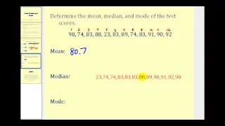
Mean, Median, and Mode

This video explains how to determine mean, median and mode. It also provided examples. http://mathispower4u.yolasite.com/

From playlist Statistics: Describing Data

Video thumbnail

Statistics Lecture 3.3: Finding the Standard Deviation of a Data Set

https://www.patreon.com/ProfessorLeonard Statistics Lecture 3.3: Finding the Standard Deviation of a Data Set

From playlist Statistics (Full Length Videos)

Video thumbnail

More Standard Deviation and Variance

Further explanations and examples of standard deviation and variance

From playlist Unit 1: Descriptive Statistics

Video thumbnail

Statistics - The vocabulary of statistics

This video will give show you a few terms that are used in statistics such as data, population, sample, parameter, statistic, and variable. Remember that it matters if you are talking about the whole group, or a portion of that group. For more videos please visit http://www.mysecretmatht

From playlist Statistics

Video thumbnail

Measures of Spread Overview

Introduction to standard deviation, IQR [Inter-Quartile Range], and range

From playlist Unit 1: Descriptive Statistics

Video thumbnail

Populations, Samples, Parameters, and Statistics

Please Subscribe here, thank you!!! https://goo.gl/JQ8Nys Populations, Samples, Parameters, and Statistics

From playlist Statistics

Video thumbnail

Statistic vs Parameter & Population vs Sample

This stats video tutorial explains the difference between a statistic and a parameter. It also discusses the difference between the population and sample. It includes examples such as the sample mean, population mean, sample standard deviation, population standard deviation, sample propo

From playlist Statistics

Video thumbnail

Introduction to Statistics

Please Subscribe here, thank you!!! https://goo.gl/JQ8Nys Introduction to Statistics - Quantitative Data versus Qualitative Data

From playlist Statistics

Video thumbnail

Public Health Seminar. The National Center for Health Statistics: Research Data Center

UCI has a new Research Data Center for campus researchers. The Research Data Center (RDC) is part of the National Center for Health Statistics (NCHS). NCHS monitors the nation's health by collecting, analyzing and disseminating health data. The RDC system was created to provide a secure en

From playlist Public Health: Graduate Seminars (2013 - 2015)

Video thumbnail

NEW AQA A Level Maths 2018 Paper 3 Walkthrough - Question 14 - Statistics: Conditional Probability

Welcome to my complete walkthrough and worked solutions to the June 2018 NEW SPECIFICATION AQA A Level Maths Paper 3! AQA A Level Maths Paper 3 is pure mathematics and statistics. These are currently the only set of past papers for the new specification A Level Maths so are essential rev

From playlist NEW A Level Maths AQA June 2018 Paper 3 Walkthrough

Video thumbnail

Where and Why Do People Move? Crash Course Geography #32

People have been migrating and transplanting since before recorded history, and understanding the reasons why people migrate can help explain some of the cultural, economic, and political patterns we see around the world. Today, we’re going to mostly focus on the Indian diaspora, which is

From playlist Geography

Video thumbnail

2015 Castle Lectures - Africa, A Search for Causes: Why has Africa been the “Final Frontier”?

The 2015 Castle Lectures - Africa: The Last Frontier for Development – Lecture 3: A Search for Causes: Why has Africa been the “Final Frontier”? Africa has lagged the rest of the developing world in terms of economic development, health, the establishment of social order, and the consolida

From playlist Castle Lecture Series

Video thumbnail

Moran's I : Data Science Concepts

How do we measure spatial correlation?

From playlist Data Science Concepts

Video thumbnail

What is space and how do we study it? Crash Course Geography #3

Today we're going to talk about SPAAAAAACE, but not like stars and satellites and stuff. Instead, we're going to talk about geographic space. In geography, we can look at the world and the places and spaces we inhabit with four distinct lenses: space as a container, topologically, socially

From playlist Geography

Video thumbnail

Data Science Tutorial | Data Science for Beginners | Data Science with Python Tutorial | Simplilearn

🔥Artificial Intelligence Engineer Program (Discount Coupon: YTBE15): https://www.simplilearn.com/masters-in-artificial-intelligence?utm_campaign=Data-Sciene-Tutorial-jNeUBWrrRsQ&utm_medium=DescriptionFirstFold&utm_source=youtube 🔥Professional Certificate Program In AI And Machine Learning:

From playlist Data Science For Beginners | Data Science Tutorial🔥[2022 Updated]

Video thumbnail

Geospatial Standards for Data Science - Dr Gobe Hobona, OGC

About the event Advances in geospatial technologies have led to a significant increase in the role of geospatial data across sectors such as agriculture, aviation, energy, utilities, hydrology, smart cities, government, health and others. As more geospatial data has been collected and ana

From playlist Geospatial Standards for Data Science

Video thumbnail

Stock Data Types in Excel - 2250

Office 365 customers will soon be seeing a new Data Types gallery in the Data tab in Excel. Convert stock symbols to a Stock Data Type. You can easily return price, CEO, Volume, and other statistics.

From playlist New in Excel for 2018

Related pages

Graph theory | Median center of United States population | Spatial analysis | Line (geometry) | Point (geometry) | Cartesian coordinate system | Seven Bridges of Königsberg | Polygon | Leonhard Euler | Centroid | Standard deviation | Center of population