Units of area | Customary units of measurement in the United States

Section (United States land surveying)

In U.S. land surveying under the Public Land Survey System (PLSS), a section is an area nominally one square mile (2.6 square kilometers), containing 640 acres (260 hectares), with 36 sections making up one survey township on a rectangular grid. The legal description of a tract of land under the PLSS includes the name of the state, name of the county, township number, range number, section number, and portion of a section. Sections are customarily surveyed into smaller squares by repeated halving and quartering. A quarter section is 160 acres (65 ha) and a "quarter-quarter section" is 40 acres (16 ha). In 1832 the smallest area of land that could be acquired was reduced to the 40-acre (16 ha) quarter-quarter section, and this size parcel became entrenched in American mythology. After the Civil War, freedmen (freed slaves) were reckoned to be self-sufficient with "40 acres and a mule." In the 20th century real estate developers preferred working with 40-acre (16 ha) parcels. The phrases "front 40" and "back 40," referring to farm fields, indicate the front and back quarter-quarter sections of land. One of the reasons for creating sections of 640 acres (260 ha) was the ease of dividing into halves and quarters while still maintaining a whole number of acres. A section can be halved seven times in this way, down to a 5-acre (2 ha) parcel, or half of a quarter-quarter-quarter section—an easily surveyed 50-square-chain (2 ha) area. This system was of great practical value on the American frontier, where surveyors often had a shaky grasp of mathematics and were required to work quickly. A description of a quarter-quarter section in standard abbreviated form, might look like "NW 1/4, NE 1/4, Sec. 34, T.3S, R.1W, 1st P.M." or, alternatively, "34-3-1 NW4NE4 1PM". In expanded form this would read "the Northwest quarter of the Northeast quarter of Section 34 of Township 3 South, Range 1 West, first Principal Meridian". (Wikipedia).

Section (United States land surveying)
Video thumbnail

Where 2.0 2010: Mark L. DeMulder, "The Digital National Map of the United States of America"

Mark L. DeMulder (United States Geological Survey), "The Digital National Map of the United States of America"

From playlist Where 2.0 2010

Video thumbnail

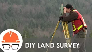
How does land surveying work?

A primer on one of the most important companions to civil engineering: land surveyors. Conventional measurement tools like a tape measure and protractor don't work for large civil structures and public works projects. Surveying is essentially the science of measuring big stuff. In this vi

From playlist Civil Engineering

Video thumbnail

Earth Science Decadal Survey Missions

This animated graphic outlines the 15 NASA Earth science missions recommended by the National Research Council in its decadal survey report published in 2007. These future missions will form the basis of a systematic space-based study of the Earth. For more information about the survey and

From playlist Mega Space Telescope Playlist

Video thumbnail

Trigonometry 4 The Area of a Triangle

Various ways of using trigonometry to determine the area of a triangle.

From playlist Trigonometry

Video thumbnail

Trigonometry made easy

Trigonometry is a branch of mathematics that studies relationships between side lengths and angles of triangles. In this video we look at the use of trigonometry with right triangles, solving for both sides and angles. To support tecmath on Patreon: https://www.patreon.com/tecmath

From playlist Trigonometry and Pythagoras

Video thumbnail

How Do Archaeologists Decide Where to Dig? | Introduction to Archaeology

Finding archaeological dig sites from the ground is so 1960s—these days they can be spotted from space. Whether walking, spacewalking, or somewhere in between, picking a site is all about the recon. Grab your short-handled shovels, axes, saws, and picks—some big rock candy mountains are ri

From playlist Ancient History

Video thumbnail

Surveying Maths A lesson 1 - finding the height and area of an isosceles triangle

In this series of videos, we will teach you the basic maths required to become a surveyor. No, it's not the maths in handing out questionnaires, this is the maths for measuring and calculating land area and distances between objects.

From playlist Maths A / General Course, Grade 11/12, High School, Queensland, Australia

Video thumbnail

Special Topics - GPS (66 of 100) WGS 84 World Geodetic System

Visit http://ilectureonline.com for more math and science lectures! http://www.ilectureonline.com/donate https://www.patreon.com/user?u=3236071 We will learn about the WGS 84 (World Geodetic System). It was established and maintained by the US National Geospatial – Intelligence Agency la

From playlist SPECIAL TOPICS 2 - GPS

Video thumbnail

THG Podcast: Border Wars

This is an episode of the THG Podcast, which posts to YouTube once every two weeks in addition to regular History Guy content, about a month after it releases to podcast services. Subscribe to the RSS feed: https://feeds.captivate.fm/thehistoryguy/ Check out our new community for fans and

From playlist Podcast

Video thumbnail

America's Greatest Border Dispute: The Story of the Mason-Dixon Line

The Mason Dixon line is the product of a famous border dispute. although it does not extend west of the Ohio River, The Mason Dixon Line is a disagreement between Maryland, Pennsylvania, Delaware, and Virginia, which resulted in the political and social divide between the North and the Sou

From playlist Pennsylvania History

Video thumbnail

The 5 Most Popular National Parks in the U.S. | National Geographic

Supervolcanoes, smoking trees, and epic valleys—see why these are the most visited national parks. ➡ Subscribe: http://bit.ly/NatGeoSubscribe About National Geographic: National Geographic is the world's premium destination for science, exploration, and adventure. Through their world-clas

From playlist Travel 5 | National Geographic

Video thumbnail

The Gadsden purchase

Special Holiday deal! Go to https://NordVPN.com/thehistoryguy or use code THEHISTORYGUY to get 68% off a 2 year plan plus 4 additional months free. It’s risk free with Nord’s 30 day money-back guarantee! On December 30, 1853, the first draft of a treaty was signed that would complete the

From playlist History without War

Video thumbnail

How the Wolseley Expedition helped define modern Canada

The History Guy remembers when, in the early days of the Canadian confederation, one of the greatest officers of the British Victorian Army, Garnet Wolseley, takes 1000 soldiers on an impossible march through the wilderness. Its importance to Canadian history deserves to be remembered. Sk

From playlist The British Empire

Video thumbnail

The Indiana Central Canal

Though nearly forgotten now as they have become largely obsolete in the face of rail and road, canals were for a time the end-all be-all of transportation technology, and the building of a canal could guarantee prosperity for the towns it traveled through. Hoping to get in on the game, the

From playlist Economic History

Video thumbnail

Hawaii and the Tanager Expedition of 1923

When Theodore Roosevelt created the Hawaiian Islands reserve for the protection of native birds, the expansive Northwestern Hawaiian island had not been the subject of a systematic scientific inquiry. The expeditions aboard the USS Tanager changed our understanding of some of the nation's

From playlist History without War

Video thumbnail

Forgotten WW2 Plane Found on Beach

Special thanks to the following groups and individuals: The Malvern Archaeological Diving Unit, for use of photographs - for more information about their survey of the plane's wreck, please visit: http://www.madu.org.uk/Page%204.28%20-%20Maid%20of%20Harlech%20-%202014.dwt A great many th

From playlist Aircraft

Video thumbnail

How They Built The World's Longest Underwater Pipeline | Megastructures | Spark

By two thousand and eight, Norway will be connected to the United Kingdom via a 1200 km super pipeline—the longest subsea pipeline in the world. But this connection is only a part of an enormous plan to tap into Norway’s second largest gas deposit, capable of providing 20% of the UK’s gas

From playlist Megastructures

Video thumbnail

NASA Tech Safeguards CA Water (live public talk)

Original air date: Oct. 19 at 7 p.m. PT (10 p.m. ET, 0200 UTC) California is is prone to both droughts and flood. There is a great disparity between where and when precipitation falls, where people live, and where crops are grown. To deal with these issues, the state has a vast array of i

From playlist Earth

Video thumbnail

Sphere Earth Conspiracy - Geodesy

Don't let anyone try to convince you that the earth is a sphere! It's actually closer to an ellipsoid. How does your airline pilot know which direction to head when he’s over the ocean with no landmarks? How do we know the exact boundaries between parcels of land and between states and cou

From playlist Civil Engineering

Video thumbnail

The Largest Concrete Dam in the U.S. - The Hoover Dam

The construction took 5 years (1931-36) during the Great Depression. It was a massive effort of design, involving thousands of workers, and cost $49 million ($836 adjusted for inflation). Its located in the Black Canyon of the Colorado River, on the border between the U.S. states of Nevada

From playlist Mega Playlist

Related pages

Chain (unit) | Survey township